GRSS-SI Chapter Officers

Ferdinando Nunziata, Chair
He is Associate professor of applied electromagnetics at University di Napoli Parthenope, has been working on applied electromagnetics and microwave (active and passive) remote sensing since 2005 and he co-authored more than 100 scientific articles on these topics. He is IEEE Senior Member, Associate Editor of IEEE JSTARS and MDPI Remote Sensing journals, member of the Cosmo-SkyMed Mission Advisory Group, and he has been involved in the organization of thematic sessions and conferences related to microwave remote sensing.

Fabio Bovenga, Vice Chair
is senior researcher at the Institute for Electromagnetic Sensing of the Environment (IRAE) of the National Research Council (CNR) of Italy. His main research interests concern advanced processing techniques for SAR imaging and SAR interferometry, and the application of multi-temporal / multi-frequencies analysis to ground monitoring, change detection, and ground parameter estimation. He is adjunct professor on “Satellite Systems for Remote Sensing and Geolocation” at Polytechnic University of Bari. He is member of IEEE.

Gerardo Di Martino, Secretary
He is Associate Professor of Electromagnetic Fields at the Department of Electrical Engineering and Information Technology of the University of Naples Federico II. His main research interests include microwave remote sensing and electromagnetics, with focus on electromagnetic scattering from natural surfaces and urban areas, SAR signal processing and simulation, information retrieval from SAR data. He is an Associate Editor of IEEE JSTARS, IEEE Access, Remote Sensing (MDPI), and Electronics (MDPI). He is a Senior Member of IEEE.

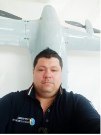
Nicola Angelo Famiglietti, Treasurer
He is researcher at INGV (National Institute of Geophysics and Volcanology). His main study interests concern research and technological development in the seismotectonics, environmental and volcanic mainly using 3 platforms: Satellite sensors, especially SAR with Interferometric and Polarimetric processing; APR (Aircraft Piloted Remotely) with implementation of on-board technology for precision positioning and use of multiple payloads (LIDAR, Georadar; Echo sounders, Magnetometers); GNSS (Global Navigation Satellite System), with the implementation of the new management, acquisition, archiving and distribution system of GNSS data and metadata of INGV National Network ( http://ring.gm.ingv.it/) and the development of services and products in Real Time with high rate.

